
Spring Valley Neighbor Sources
For Spring Valley neighbors, the public record starts with land geography rather than names. Rockland GIS can locate an address or Tax ID and display tax parcels, roads, municipal boundaries, and district layers. The Town of Ramapo's PROS record then helps connect a selected parcel to assessment information. The County Clerk's land records can establish a recorded ownership chain. Each source has a narrower purpose than a general neighborhood list.
| Block source | What it adds around an address | Access method |
|---|---|---|
| Rockland GIS Base Map | Adjacent parcel geometry, roads, boundaries, districts, land-use, environmental, and topographic context | Public map; search, click, pan, and identify |
| Ramapo PROS Street Finder | Assessment addresses on a selected town road and owner or prior-owner matches after opening results | Public property search; filter by village boundary in GIS |
| Rockland County Clerk land records | Grantor-grantee chain, legal description, recording date, and deed lead for each parcel | Cott guest view, search room, or copy request |
| Village permits and code files | Work, certificate, violation, applicant, or owner history tied to an address | Written Village request or FOIL channel |
| Cross Reference Directories | Historic address-to-occupant or business references for 1978 through 1999 | New City Library Rockland Room |
These records show different layers. An owner is a party in an assessment or deed record. A person in a permit may be an applicant or agent. An old directory entry is a dated lead. None proves every person who may be at a Spring Valley address today. Preserve the source and retrieval date for each nearby parcel instead of combining them into one unsupported statement.
Map Spring Valley Neighbors
Rockland GIS supplies the most direct Spring Valley block method. Search the anchor address, choose the matching map result, and leave the tax-parcel layer on. Click the anchor polygon first, then pan or zoom outward and click each polygon that shares a side or corner. County documentation confirms parcel, road, municipal-boundary, election, political, school, census, land-use, historic, environmental, and topographic layers. It does not document a public buffer or radius control, so contiguous parcel browsing is the supported method.
- Find the anchor address in the GIS Base Map and write down its SBL or Tax ID, road name, and municipal boundary result.
- Click the north, south, east, and west adjoining polygons. Record each parcel ID, road frontage, and the political, election, school, or census district shown by the map.
- Open each selected parcel in Ramapo PROS to compare the assessment owner or prior-owner match with the property location.
- Search the owner as grantee in Cott eSearch, then match the legal description or SBL before treating a deed as the same Spring Valley parcel.
- Request a narrow permit, certificate, or code record only when its address history answers a separate question. Keep each item labeled by source and purpose.
For a whole named road rather than the immediate block, the Spring Valley Street Directory uses the Street Finder and a broader parcel chain. The block method stops at the adjoining parcels. It is not a way to infer a full household list.
Spring Valley Parcel Boundaries
A Spring Valley address has several identifiers that should not be merged. The situs address is the physical parcel location. A mailing address is where tax correspondence goes and may belong to an attorney, trustee, management business, or a different location. The legal description or SBL identifies the parcel in assessment and deed work. When one of those fields changes, the parcel ID and recorded description are often the bridge.
GIS can show a selected polygon, street frontage, district, and municipal context. It is a spatial check, not a complete ownership record. PROS is the assessment follow-up, while the Clerk's index carries the deed relationship. The county cautions that online SBL references are not verified. Confirm a disputed or unclear number with the town or village assessor before relying on it. That extra check is valuable where a road crosses the Spring Valley boundary or a historic lot was split or combined.
- Parcel
- A defined piece of land shown on a tax map and usually tied to an assessment identifier.
- Situs
- The physical location of a parcel, distinct from a mailing destination.
- SBL
- A section, block, and lot style tax-map identifier used to connect assessment and land records.
- Legal description
- The lot, block, subdivision, or metes-and-bounds wording that identifies land in a recorded instrument.
Spring Valley Neighbor Records
Adjacent parcels can lead to useful public records, but the evidence stays parcel-specific. A Cott land result can list grantor, grantee, party role, document or instrument number, recording date, legal description, and image link. A deed may also contain a prior-deed reference, consideration clue, estate language, or easement. It is transfer evidence, not proof that a named person currently occupies the address.
Village permit and code records are another limited layer. The Village FOIL form supports a narrow address, permit-type, and approximate-year request when the online forms page has no public permit index. The Building Department states a five-business-day response window and 25-cent ordinary paper copies. Village Code Enforcement can retain complaint, inspection, and violation material, but a name in such a file may be an owner, agent, inspector, or complainant.
New York voter records do not create a public block roster. The individual voter portal requires identity details and is designed for registration verification. A broader file requires an elections-purpose statement, and protected identifiers remain closed. District layers on the GIS map can give Spring Valley civic geography without attempting to identify voters at neighboring parcels.
Spring Valley Community Layers
Community resources can supply organization or historical context after the parcel work is complete. They are not substitutes for a land record and do not document private household membership. The research found a public business and organization directory, public village calendars, and county historical resources. It did not find a verified official HOA or neighborhood-association directory for incorporated Spring Valley, so no membership list should be assumed to exist.
| Local resource | What is public | Appropriate use |
|---|---|---|
| Spring Valley Area Chamber | Keyword search, Advanced Search, and public business or organization listings | Check a business or organization affiliation, not a private address |
| Village calendar | Board, Planning, Zoning, Community Development, and Police calendar filters | Locate public hearings, agendas, or organization contacts |
| Genealogical Society of Rockland County | Cemetery, church, funeral-home, census, and archive research resources | Place historic families or community ties in time |
The Chamber directory had 84 member listings and 32 general listings when inspected. It covers businesses and organizations, not the people on a block. The local NAACP's public history and the GSRC's church or cemetery resources are similarly civic or historical layers. They can help locate a public contact or archival lead, but neither is a neighbors directory.
Spring Valley Business Neighbors
A business name found in a deed, permit, obituary, or state filing may be checked against the public Chamber directory as an affiliation lead. That can clarify whether an organization has a Spring Valley connection, but a listed process address, officer, or agent cannot be converted into a personal address. The category is useful only when it is clearly labeled as a business or organization record.
The Spring Valley Area Chamber directory provides the searchable public organization layer shown here.
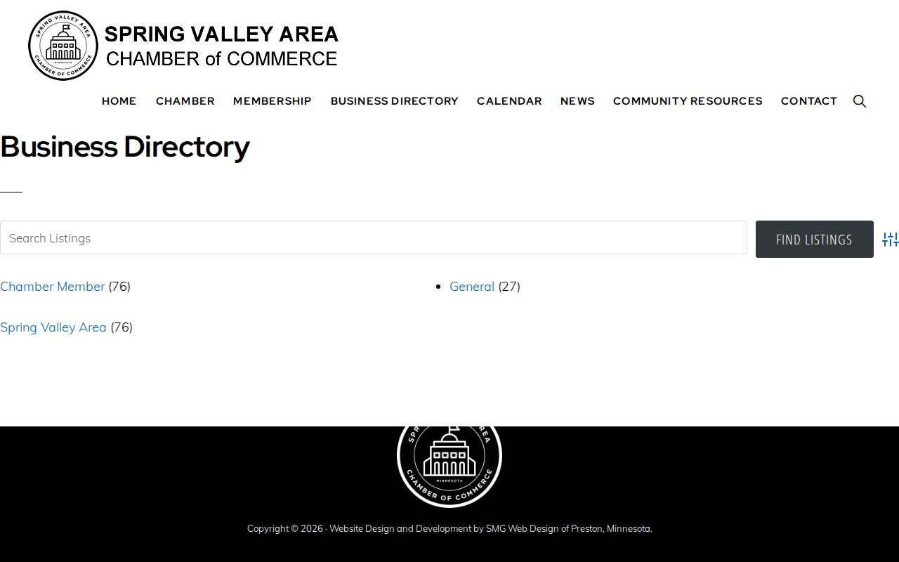
Its keyword and Advanced Search controls can help confirm a public organization name associated with a parcel or meeting item. They do not show a household roster, and a result should be corroborated with the relevant public filing or municipal record.
Spring Valley Meeting Connections
Village meetings can add a dated public-record layer to an address question. The calendar has filters for the Board of Trustees, Planning, Zoning, Community Development, Police, and Assessors. Agendas and minutes may name a public applicant, owner, attorney, official, or organization representative. The person named in a hearing is participating in that public matter; the record does not establish a broader relationship with all Spring Valley neighbors.
When a document is not posted, request the existing agenda, minutes, permit, certificate, or code material by a precise address and date range. The Village Clerk's records access program provides inspection and copying channels. Under New York FOIL, Public Officers Law Article 6 §§ 84, 87, and 89, a request should go to the agency that maintains the record. That narrow approach is more useful than asking the village to identify everyone near an address.
Spring Valley Civic Neighbors
Historical sources help explain a Spring Valley block without exposing a current personal roster. The New City Library Rockland Room holds Cross Reference Directories from 1978 through 1999, county telephone books from 1910 through 1998, newspapers, census material, and maps. GSRC supports church, cemetery, funeral-home, and census research. The Spring Valley Branch NAACP was chartered June 25, 1951 and is a civic-history point of contact, not a membership directory.
Older geography matters too. A portion of Clarkstown was annexed to Spring Valley village in 1945, so a historic tax or census item may use Clarkstown or a "part" label. Pair that label with a street, legal description, map, or directory date before connecting it to the modern block. The 1918 Spring Valley Sanborn set can show building form and street layout, but it does not name people.
Spring Valley Neighbor Privacy
Official sources and commercial neighbor tools answer different questions. Official parcel, clerk, and permit records identify the public fact held by the custodian and provide a path to an image or clerk check. Commercial tools compile data from many sources, may merge same-name records, and can retain stale addresses. Neither category can justify publishing a private household list, and the official record should be used to verify a specific, lawful question.
| Official record route | Parcel, deed, permit, or public meeting information with a named custodian and date. |
|---|---|
| Commercial category | Compiled data that may be incomplete, costly, stale, or mismatched and requires separate accuracy checks. |
| Sound conclusion | State only the public fact the underlying source supports, such as a parcel owner or public filing role. |
The New York Address Confidentiality Program protects eligible participants through a substitute address under Executive Law § 108. DMV addresses, utility subscriber data, protected voter details, sealed court material, and private membership lists remain outside a neighbor lookup. Do not attempt to reverse a substitute address or infer private details from a gap in a public record.